The 4 mythical passes of the Tour de France in the Pyrenees
The passes of the Tour de France
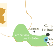
The route des cols linking the Mediterranean to the Atlantic is a tourist excursion that can be done by car in its entire length, with a few stages. But it can also be done in portions from your Le Ruisseau campsite, ideally located for crossing these mythical passes. For cycle touring enthusiasts, we’ve drawn up a list of the passes in the Hautes Pyrénées, on the western and eastern sides, to guide you on your escape, in the image of the Tour de France champions who so often climbed these passes.
The 5 cycle tours of the Hautes Pyrénées
Col de Peyresourde
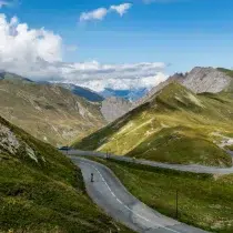
The Col de Peyresourde links the Louron valley to the Haute Garonne. A series of authentic little mountain villages dot the route. This wide, broad pass offers breathtaking panoramic views of the surrounding mountains and valleys.
Once at the summit, you can take a break in a crêperie-bar with a warm atmosphere from June to October. For cyclists: The Col de Peyresourde is a regular feature of the Tour de France.
Discover the climbs
The climb up the eastern slope starts from Bagnères de Luchon. As soon as you leave the town, the slope steepens:
- Length: 14.3km
- Difference in altitude: 950m (start altitude: 625m – finish altitude: 1569m) – average: 6.6% – maximum: 8.5
The ascent via the west-facing slope starts fromArreau. The slope steepens from the village of Estarvielle, in the Louron valley.
- Length: 18.7km
- Difference in altitude: 860m (start altitude: 705m – finish altitude: 1569m) – average: 7% maximum: 9.5
Col d’Aspin
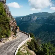
Linking the Campan valley to the Aure valley, this pass is one of the last road passes to be completed. It has been on the Tour de France program 74 times.
In a session of the legislative assembly in 1868, Achille Jubinal, deputy for the Hautes Pyrénées, exclaimed: “five or six years ago, we only crossed the Col d’Aspin on horseback. Now, thanks to the Emperor, who personally came up with the idea of thermal roads, we can cross the Col de la Torte and the Col d’Aspin at 1,800 meters above sea level; at Tourmalet, as well as at the Col de la Peyresourde down through Luchon, we can cross at 2,000 meters with four-horse-drawn carriages, as easily as you cross the Place de la Concorde in a Daumont (laughs). So why shouldn’t a railroad penetrate where cars now go?”
Discover the climbs
The special feature of this side of the Col d’Aspin is the presence of hardwood trees by the roadside at irregular intervals on a winding ascent through pastoral meadows.
The ascent of the eastern slope, shorter and more arduous than the western one, takes place just outside Arreau.
- Length: 12.5km
- Vertical drop: 790m (start altitude: 705m – finish altitude: 1489m) – average: 6.5% – maximum: 9.5
The ascent on the west side starts from Bagnères de Bigorre.
- Length: 12.5km
- Difference in altitude: 934m (start altitude: 555m – finish altitude: 1489m) – average: 3.8% – maximum: 7.5
The Tourmalet pass
At 2115 m, it is the highest road pass in the Pyrenees.
It is dominated by two peaks: the famous Pic du Midi and the Pic d’Espade. It links the Gave de Pau to the west and the Adour valley to the east. The Col du Tourmalet is part of the “legend of the Tour”.
This pass was crossed in 1088 by Beatrix1st of Bigorre to collect taxes in Barèges. Then, in the 17th century, it was crossed by the heads of the French nobility on their way to take the waters at Barèges. It was for this reason that it was built in 1688 and became a road in 1730, but it wasn’t until the construction of the thermal road in 1864, commissioned by Napoleon III, that the passage was safe. It is generally open from June to November.
In summer, the Tourmalet is a popular destination for mountain bikers, while in winter, the two sides of the mountain become the realm of skiers (the Grand Tourmalet).
Discover the climbs
The east-facing ascent from Campan A very long climb.
- Length: 22.5km
- Difference in altitude: 1268m (start altitude: 660m – finish altitude: 2115m) – average: 6% – maximum: 9%.
The ascent on the west side, from Luz-Saint-Sauveur
- Length: 19km
- Total ascent: 1404m (start altitude: 711m – finish altitude: 2115m) – average: 7.4% – maximum: 10.2
The ascent via the east-facing slope from Campan.
- Length: 22.5km
- Difference in altitude: 1268m (start altitude: 660m – finish altitude: 2115m) – average: 6% – maximum: 9%.
Col du Soulor
Rising to 1474 meters, this pass links the Arrenzs valley with the Ouzom valley in the Hautes Pyrénées.
It’s one of the major tourist attractions of the Val d’Azun winter sports resort, since it’s been developed for Nordic activities: cross-country skiing, snowshoeing, dog sledding and, of course, hiking in summer. The starting point for numerous half-day walks and a 300 m-long zip-line descent, the Col du Soulor offers family-oriented activities and is accessible all year round.
Discover the climbs
The ascent via the eastern slope starts from Argelès-Gazost.
- Length: 19.4km
- Difference in altitude: 1019m (start altitude: 463m – finish altitude: 1474m) – average: 5.2% – maximum: 8.5
The ascent on the west side is from Laruns via the Col d’Aubisque.
- Length: 28.4km
- Vertical drop: 1180m (altitude start: 525m – altitude Col d’Aubisque: 1709m – Altitude finish: 1474m) -average: 7.9% -maximum: 10%
The Soula refuge interpretation trail
Finally, this cycle tour or hike is well worth the detour without crossing a mountain pass! However, the goal may be to climb to the Soula refuge. This is the Upper Louron Valley interpretation trail, overlooking the magnificent Clarabide Gorge. This walk takes you through an exceptional area for the preservation of flora and fauna. It’s a “nature bath” that will undoubtedly recharge your batteries with renewed energy.
Find out how to access it
To climb by bike, from Le Ruisseau campsite, head for Couartaou (4km) and join the D725 as far as Pont du Prat.
- Duration: 3h round trip
- Minimum altitude: 1,260 m – Maximum altitude: 1,760 m
- Difference in altitude: 450 m
- Easy to moderate level.
Start: Pont du Prat parking lot (signposted from Loudenvielle).
Take advantage of your stay at Camping du Ruisseau to explore the route des cols. Book your accommodation– a mobile home, chalet or pitch – at camping du Ruisseau de Gouaux, in the Saint-Lary-Soulan valley.
